|
|
|
tidal 2000
start, scotch quay
waterford
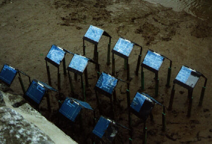
Tidal is located between the tidal zones on the River Suir. It consists of
12 house like structures, whose roofs are made up of open ring binders. The
12 ring binder roofs collectively host, in the form of a tiled image, a tract
from the Charles the First Charter of 1626 bequeathing the land and waters
around Waterford to Lord Waterford.
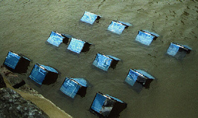
This archaic tract describes the territory as being enclosed by townlands.
The other side consists of a map of the environs of Waterford. Responsibility
and ownership for the River Suir changes according to the tidal depth. A tidal
river is an ephemeral territory, a point where constantly moving fresh water
meets salt water. It is difficult to quantify. It is an interesting metaphor
for the entropy that permeates many current issues.
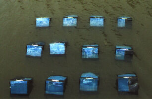
This piece uses a variety of visual devices. A map, a legally binding, ludicrously
vague piece of text, a bizarre 'settlement' of ' houses' and a tidal zone site
constitute an effort to look at how these issues of territory permeate so many
situations.
The houses become structures that don't require planning permission. Their
location and the tide's action upon them, could be seen to reference rezoning,
housing and settlement policies.
The colonial issues raised by the 1626 Charter still abound. Rigid efforts
to define and allocate territory remain in existence.
Mixed media,
laminated inkjet prints on ring binders
10'.10'.4'./ 300cm. 300cm. 120cm
|